- Todos
- 1-Guayatayoc
- 2- Olaroz
- 3- Jama
- 4- Salinas Grandes
- 5- Cauchari
- 6- Rincón
- 7- Pozuelos y Pastos Grandes
- 8- Pocitos
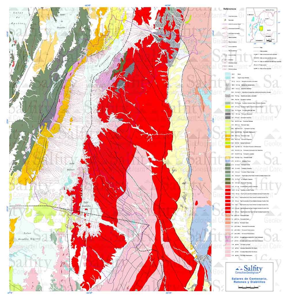
- 9- Centenario-Ratones y Diablillos
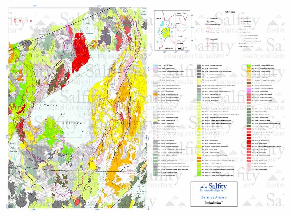
- 10- Arizaro
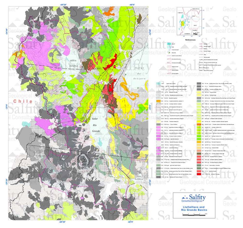
- 11- Llullaillaco y Río Grande
- 12- Antofalla
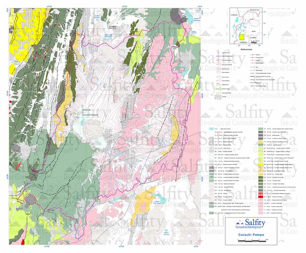
- 15- Carachi Pampa
- 16- Incahuasi
- 17- Laguna Verde